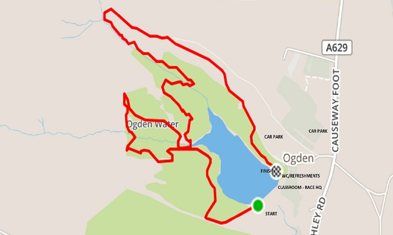
There will be no race this year due to unexpected family commitments. Hopefully back next year. Ogden Midsummer Madness is a Category AS fell race which takes place at the stunning Ogden Water nature reserve in North Halifax. It will normally be on the Wednesday evening closest to midsummers day. In 2026 race the will take place on Wednesday 17th June. The start is at 7 pm (for age 16 upwards). This is a very beautiful, but very demanding Category A fell race with around 1000ft of climb in 3.5 miles. It features stoney trails, boggy ground, narrow ridges, steep climbs and technical descents, several "wet feet" stream crossings, tussocks, ravines, waterfalls and steep stone steps .... with a fast, runnable downhill finish. It is very easy to get lost in the woods, so prior recces are advised. Registration opens at 5.30 pm in the classroom by the visitor centre, entry on the day £5 FRA/£6 non FRA. Halifax Harriers organise this race as a fundraiser to support the maintenance of the Ogden Water nature reserve. Presentations will take place afterwards at The Causeway Foot Inn, where extra parking is available in the field behind the pub. Free camping is available in the field (with prior notice) for those that wish to travel from further afield and stay over.
| Link to Strava route |
https://www.strava.com/segments/19774790 |
| 2019 photos by Woodentops | |
| Race Records |
Open Record: Ben Crowther 27:07 2019 Female: Martha Tibbet 29:50 2023 |
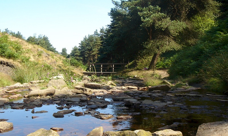
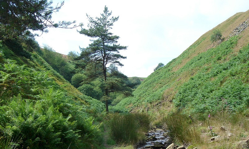
The route has everything: good runnable tracks, undulating terrain, lake, woodland, three stream crossings, stone steps, a narrow ridge, a couple of boggy bits, technical descents, technical climbing, waterfalls and a super fast last mile, finishing by the beautiful Ogden Water. |
The race starts at the western end of the dam heading first up towards the Withins. |
At the first wooden gate turn right through it (it will be open on race night, on recces use the stile) and follow the stoney vehicle track down towards the lake, bearing left at the bottom of the hill, and follow its undulations all the way to the Skirden Clough bridge/silt trap at the end of the reservoir. Carry straight on up hill keeping Skirden Clough stream on your right. After a short rise take the left turn which is a narrow trail path winding up to a bench. Go past the bench and after approximately 10 metres turn right off the gravel path onto a marked grassy path heading W. |
Follow this gradual incline for about 70 metres then take a smaller marked grass track to the right (North) aiming towards the Scots Pines. Approach with caution as the path drops almost vertically, before heading NW into an area known as Spice Cake Hills. This is a series of ridges and valleys formed by landslips. The route descends slightly but then takes a marked left fork, through boggy ground and long grass, hugging a ridge on your left. After a short while, at a sycamore with low branches which is on your left, look for a marker and head S towards the ridge and scramble up (slippery slope) onto the top of it. Here you head right and follow the ridge summit, NW all the way to the end where you will be faced with a fence and open country. |
Turn right and follow the track down towards the Skirden stream. It is a narrow descent riddled with tree roots. Approximately 15m short of the stream take the marked path left towards the stream which will need to be jumped.... you will see a marked track on the opposite bank which rises up to the left. |
Take this track following it up towards the fence line, but just before you get there, deviate from it to the right up a shallow gully (marked). ... clambering up over logs and broken ground ... about 5 metres. Climbing out of the top head up the hill following the marked path. It's a steep climb. It follows the line of a deep gully which is to your right, but look out for a faint track which veers left (marked). Follow that towards the fence then it straightens up again towards the gully, which has turned left across your path. Be aware that there is a steep and deep drop unless you find the correct crossing point which is next to a contorted pine tree. Cross the gully there and then veer immediately left and follow a faint line over towards the fence bordering open country. This whole section is marked with pegs and the cut bracken should make the route fairly obvious. |
Upon reaching the fence bear right and continue to climb through the tussocks. At the second fallen tree (just before open grass tussocks) you will clamber over its trunk and around to your right. This is where you pick up the path from the Giants Tooth and head back down the hill having almost doubled back on yourself. Some 100 metres down this descent there are the bases of tree trunks in the middle of the track and a marked track veers off to your left. Take this left which soon opens up to be a very fast runnable descent back towards the reservoir. Stay on it all the way to the bottom, It will bear right (marked) and through a ford over a weir in Skirden stream. Head up the track out of the other side and then left back towards the reservoir...turn left across the bridge and then immediately left again up the quad bike track (marked). |
Climb a short way on the quad bike track and where it forks, take the right fork (marked). This takes you up into the woods ... you may have to duck under overhanging branches. Look out for the marker peg under some low hanging beech foliage. Go left through the folieage and follow the deep rutted quad track which is often waterlogged. The magic beech tree will be to your left, marker pegs will lead you to a path T junction. Turn left there. You should see a long, straight climb ahead of you which heads up towards the Giants Tooth. |
Climb up as far as where the gradient levels out and you are in open ground ...and there is a bench on your right. Turn right on the faint path by the bench. Look for the marker. This takes you on a steep descent. Watch out for brambles. This deer track meets another ... bear left on that down to a flat plateau. There turn immediately right. You will run diagonally in an aproximately easterly direction, down through beech woodland over some quite unstable ground. This section is marked with a suggested line but you can pick your own way through the storm damaged trees until you arrive at the stream in Ogden Clough. You must make the stream crossing at the area where the stream bed widens significantly. This will have a marker on race day but there are pegs to guide you on recces. The climb out of the stream is through a tangle of tree roots. Head up the steep bank. When you meet the gravel path turn left heading upstream in Ogden clough. On race night this will be marshalled and it is where the time cut off (7.45) will be enforced. |
Follow the water basically. Keep on the path up adjacent to the stream past lots of little cascades and pools until you climb a stile out of the wood. Follow the permissive path. GO LEFT over the first bridge then follow the strem untill you are forced to cross back across stream on stepping stones. Continue up following the stream (it is now on your left) until you reach Ogden Kirk (gritstone outcrop) where you go up to your right and through the gate in the new fence and up the stone steps. |
At the top of the stone steps turn right and follow the track back towards Ogden car park. There will be a gateway where Back Lane heads east. You need to take the small metal gate up to your right, then continue the fast grassy Descent towards the car park. You'll encounter a concrete road on a steep-ish downhill slope. When you reach the bottom of that slope look to your right. Take the gate back into the woods and bear immediately left onto a marked mud path which follows the line of the boundary dry stone wall (which is on your left). The path crosses a couple of small creeks then bears right ...you will encounter a made gravel path crossing your way. Go straight across the gravel footpath between some shrubs. Head downhill then bear diagnally left, across a small drainage creek eventually turning left onto a tree root strewn path which follows the line of the reservoir dry stone wall (although some 10 metres inside of the wall). The path disappears as you cross an area of beech trees but hold your line as it re-appears on the other side. This path eventually brings you to a gap in the wall and onto the reservoir-side path. Turn left and sprint towards the finish which is in the duck feeding and picnic area. |